Best GPS Unit for Reservoir Fishing
It can be incredibly frustrating to head out on a vast Georgia reservoir, eager to find those elusive fishing hot spots, only to feel like you're just drifting aimlessly. You know the fish are out there, hugging structure or deep ledges, but without the right tools, it's like searching for a needle in a haystac k. This guide is here to equip you with the knowledge to choose the best GPS unit for your reservoir fishing adventures, helping you navigate, mark key locations, and ultimately, catch more fish.
Why a GPS Unit is a Game-Changer for Reservoir Anglers in Georgia
For years, many of us relied on landmarks, paper maps, and a good sense of direction. While there's certainly a nostalgic charm to that, the truth is, modern reservoir fishing demands more precision. Georgia's major reservoirs, like Lake Lanier, Lake Oconee, or Clarks Hill Lake, are sprawling bodies of water with countless coves, submerged creek channels, humps, and brush piles. Trying to remember exactly where you found that school of crappie last week, or that deep structure holding big bass, is nearly impossible without help.
A dedicated GPS unit, or a unit with robust GPS capabilities, transforms your fishing experience from a guessing game into a strategic hunt. It allows you to pinpoint exact locations, save them as waypoints, and return to them with uncanny accuracy, time after time. Think about the advantage of knowing exactly where that brush pile you dropped is, or consistently hitting that sweet spot on a submerged timber line that holds a healthy population of largemouth bass. This kind of precision not only saves time but significantly increases your chances of a successful outing, especially when you consider Best Fishing Spots in Georgia.
This technology becomes even more critical when you're trying to re-find a productive area that might be completely featureless above water. Perhaps it's a subtle contour change on a deep flat, or a small rock pile tucked away on a main lake point. Without GPS, these spots are effectively "lost" once you move away. With it, they become part of your personal fishing map, growing more valuable with every successful trip. It’s like having a digital breadcrumb trail that leads you back to your treasures, making those early morning departures and late evening returns much more efficient.
Key Features to Look For in a Reservoir Fishing GPS
When you're trying to pick out a GPS unit for fishing Georgia's big reservoirs, it's easy to get overwhelmed by all the options. But don't fret! Let's break down the essential features that will make the biggest difference in your fishing success. These are the aspects that separate a "good enough" unit from a truly great one that will become an indispensable tool on your boat.
High-Definition Mapping and Charting
The backbone of any good fishing GPS is its mapping capabilities. For reservoir fishing, you absolutely want detailed contour maps. Look for units that come pre-loaded with high-definition charts of Georgia's lakes, or units that allow you to download or purchase detailed mapping packages. These maps will show you depth changes, creek channels, roadbeds, and other submerged structures that are invisible from the surface. Brands like Lowrance, Garmin, and Humminbird are well-known for their detailed mapping options, often boasting contour lines down to one foot. This level of detail is crucial for understanding How Water Temperature Affects Fish Behavior and finding those fish hiding spots.
Imagine you're trying to locate a specific creek channel on Lake Allatoona that you suspect holds a school of striped bass. With a basic GPS, you might see the general outline, but a high-definition map will show you the exact twists, turns, and subtle depth variations of that channel. You'll be able to identify ledges where fish might be staging, or humps nearby where they could be feeding. This precision empowers you to dissect the lake bottom like never before, giving you the confidence to cast exactly where you believe the fish are hiding. Without accurate charts, you’re just guessing at what lies beneath the surface.
Waypoint Management and Storage
One of the most powerful features of a fishing GPS is the ability to mark and manage waypoints. A waypoint is simply a saved location, like a specific brush pile, a productive stump, or the entrance to a hotspot cove. You'll want a unit that offers ample waypoint storage, allowing you to save hundreds, if not thousands, of spots. Beyond just saving, the ability to organize these waypoints (e.g., by species, date, or type of structure) can be incredibly useful. Some units allow you to name waypoints descriptively, making it easy to remember what makes each spot special.
Consider a scenario where you've spent an entire day fishing Lake Seminole Fishing Guide and have found several promising areas for bass and crappie. As you catch fish, you can quickly drop a waypoint. When you review your trip later, being able to label these points "Crappie Brush Pile 10ft" or "Bass Ledge SW Corner" makes all the difference for future trips. This helps you build a personal database of productive spots over time. Look for units that have intuitive interfaces for adding, editing, and deleting waypoints, as well as the ability to share them with fishing buddies or transfer them to a computer for backup.
Screen Size and Readability
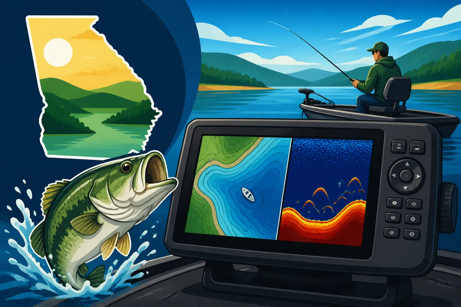
When you're out on the water, battling sun glare, boat chop, and the excitement of a bite, you need a screen that's easy to read at a glance. Screen size is a personal preference, but generally, bigger is better for navigation and interpreting maps. A 7-inch screen is a good minimum for a dedicated unit, with 9-inch or 12-inch screens offering even more real estate for split-screen views (showing map and sonar simultaneously). Beyond size, consider screen resolution and brightness. A high-resolution screen with good backlighting will provide crisp, clear images even on the brightest Georgia summer days.
Think about how often you'll be glancing at your screen – it's your primary navigational tool. Squinting at a small, low-resolution display in direct sunlight is not only annoying but can also be unsafe. Many modern units feature anti-glare coatings and vibrant color palettes designed for marine use. When you're trying to navigate a complex river system like the Flint River while searching for shoal bass, a clear, large display is invaluable for quickly identifying turns, channels, and hazards. A good rule of thumb: if you can clearly see your desired information without leaning in or shading the screen, you’re on the right track.
Standalone GPS vs. GPS/Fish Finder Combos: Which is Right for You?
One of the biggest decisions you'll face when considering a GPS unit for reservoir fishing is whether to get a standalone GPS or a combo unit that includes a fish finder. Both have their merits, and the "best" choice really depends on your existing setup, budget, and how you prefer to fish. It's not a one-size-fits-all answer, so let's weigh the pros and cons.
The Dedicated GPS Unit
A standalone GPS unit focuses solely on navigation. It excels at displaying detailed maps, tracking your position, managing waypoints, and charting courses. These units are often more compact and can be a good option if you already have a high-quality fish finder or a boat with integrated electronics. They tend to be straightforward, with dedicated buttons and menus for navigational tasks, which some anglers prefer for simplicity. You might find a wider selection of specialized marine electronics at places like Bass Pro Shops, where you can compare features side-by-side.
The primary advantage here is that you're investing purely in navigation. If your current fish finder is doing a stellar job of showing you what's under the boat, but you need better map detail and waypoint management, a standalone GPS can fill that gap without redundancy. For instance, if you're regularly fishing Lake Lanier Fishing Guide, Georgia and already have an older, reliable sonar unit, adding a modern GPS for its mapping capabilities and processing speed can significantly upgrade your navigational prowess without breaking the bank. It also means if one unit malfunctions, you still have the other working, which is a nice safety net.
However, the downside is obvious: you don't get sonar capabilities. You'll still need a separate fish finder to see fish arches, submerged timber, or bottom contours in real-time beneath your boat. This means more mounting space, more wiring, and often, two separate power sources. It's a trade-off between specialization and integration. For those who want everything on one screen, or who are starting from scratch, a standalone unit usually isn't the most practical first choice for fishing.
The GPS/Fish Finder Combo Unit
For many anglers, especially those just starting out or looking to upgrade their entire electronics suite, a GPS/fish finder combo unit is the clear winner. These units integrate both functions into a single display, allowing you to view maps, sonar, and often side-imaging or down-imaging, all at once on a split screen. This saves space on your console, simplifies wiring, and makes it incredibly efficient to navigate to a spot and then immediately start scanning for fish. This is often what anglers mean when they refer to Best Fish Finders for Georgia Reservoir Fishing.
These combo units come in a vast array of sizes and with various transducer technologies. For reservoir fishing, you'll want to prioritize units that offer CHIRP sonar, DownScan (or Down Imaging), and SideScan (or Side Imaging). CHIRP provides incredible target separation, making it easier to distinguish individual fish from structure. DownScan gives you a picture-like view directly beneath your boat, showing detailed structure. SideScan allows you to scan wide areas to either side of your boat, perfect for locating submerged timber, brush piles, or schooling fish off to the side, especially when you're targeting specific areas like Best Bass Fishing Spots on Lake Lanier.
The convenience of having everything on one screen is hard to beat. You can navigate a channel on Lake Oconee Fishing Guide, Georgia while simultaneously watching your sonar for schooling hybrid striped bass or crappie. When you find a promising mark, you can instantly drop a waypoint, all without switching between devices. While these units can be a larger upfront investment, their integrated functionality and advanced imaging often make them the most popular choice for serious reservoir anglers. For those on a budget or looking for quick delivery, Amazon often has competitive deals on these combo units, although Bass Pro Shops might offer more hands-on assistance with setup and accessories.
Here's a quick comparison to help you visualize the differences:
| Feature/Consideration | Standalone GPS Unit | GPS/Fish Finder Combo Unit |
|---|---|---|
| Primary Function | Navigation, Mapping, Waypoint Management | Navigation, Mapping, Waypoint, Sonar, Imaging |
| Best For | Adding navigation to existing sonar, minimal space | All-in-one solution, new setups, comprehensive view |
| Complexity | Simpler interface, focused on navigation | More features, potentially steeper learning curve |
| Mounting Space | Less | More (if larger screen), but fewer total units |
| Wiring | Minimal | More complex (transducer, power) |
| Cost | Generally less (for navigation only) | Generally more (for integrated advanced features) |
| Target Angler | Someone who values dedicated navigation or has existing sonar | Angler who wants all data on one screen, maximum efficiency |
Maximizing Your GPS Unit's Potential on Georgia Reservoirs
Having a great GPS unit is only half the battle; knowing how to use it effectively is where the real magic happens. Georgia's diverse reservoirs offer endless opportunities, and a well-utilized GPS can unlock many of their secrets. It's all about preparation, real-time application, and learning from every trip.
Pre-Trip Planning and Map Study
Before you even launch your boat, your GPS unit can be an invaluable tool for planning. Spend time at home studying your reservoir's maps. Look for key features like deep creek channels, points, humps, submerged roadbeds, and sharp drop-offs. Many units allow you to mark potential waypoints from your couch. Identify areas that might hold fish based on seasonal patterns or target species. For example, in early spring, you might be looking for shallow coves with dark bottoms that warm up quickly for bass, while in summer, deep main lake points or submerged timber might hold striped bass or crappie. This pre-planning can save you hours of aimless searching on the water.
This is especially helpful when researching spots on a new lake or preparing for a tournament. You can "scout" an entire lake virtually, marking dozens of potential fishing spots. By the time you hit the water, you're not just guessing; you have a strategic plan of attack. You can mark potential brush piles near marinas, or deep channels on Lake Sinclair where you might find catfish. Many mapping programs even allow you to add shaded depth contours, making it easier to visualize structure at a glance.
Waypoint Management and Trail Following
Once on the water, actively use your GPS to drop waypoints on anything interesting. Caught a fish from a specific stump? Mark it. Found a brush pile on your sonar? Mark it. Noticed a subtle depth change that looks promising? Mark it. The more waypoints you accumulate, the richer your personal fishing map becomes. Over time, you’ll start to see patterns emerge, helping you identify what types of structure are most productive at different times of the year or under certain conditions. Don't be shy about marking everything! It's much easier to delete an unproductive waypoint later than to wish you had marked a good one.
Beyond individual waypoints, use the trail feature to record your path. This is especially helpful when navigating through complex areas or trying to retrace your steps. If you find a productive trolling run for striped bass, saving that trail allows you to precisely repeat it on subsequent trips. You can follow your previous path with accuracy, ensuring you cover the same ground that yielded success before. This is critical for techniques like trolling for Deep Water Techniques for Striped Bass or meticulously working a contour line.
Understanding and Utilizing Depth Contours
Your GPS unit's detailed depth contours are arguably its most powerful feature for reservoir fishing. Fish are inherently tied to structure and depth changes, whether it's a bass holding on a drop-off or crappie suspended over a submerged creek channel. Learn to interpret these lines and understand what they represent in terms of fish habitat. A series of tightly packed contour lines indicates a sharp break or steep drop-off, often a highway for bass and other predators. Widely spaced lines suggest a gradual slope or flat.
By understanding these contours, you can position your boat to cast effectively or troll along specific depth ranges. For instance, if you're fishing West Point Lake Fishing Spots, Georgia and see a finger that drops from 10 feet to 30 feet quickly, you know exactly where to focus your efforts. Many units even allow you to customize color palettes for depth ranges, making it visually striking to identify certain depths. Combining this visual information with your sonar data on a combo unit allows you to build a comprehensive picture of the underwater world, dramatically improving your ability to locate and catch fish.
Advanced GPS Techniques for Savvy Anglers
Once you're comfortable with the basics, there are several advanced techniques that can elevate your GPS game even further, turning your unit into an indispensable strategic partner on the water. These strategies involve digging deeper into your unit's capabilities and thinking more critically about how fish relate to their environment.
Creating Custom Maps and Shaded Depth Ranges
Many modern GPS units, particularly the higher-end models from brands like Garmin (with Quickdraw Contours), Lowrance (with Genesis Live), and Humminbird (with AutoChart Live), allow you to create your own custom, high-definition maps in real-time as you drive over an area. This is a game-changer for finding those undocumented, subtle nuances of the lake bottom that aren't on standard charts. As you drive, your unit records sonar data and instantly draws highly detailed contour lines on your map. This can reveal small humps, ditches, or brush piles that might otherwise go unnoticed.
Furthermore, learning to utilize shaded depth ranges can make your map much more intuitive. Instead of just lines, you can assign different colors to specific depth ranges. For example, you might color 0-5 feet green, 5-15 feet yellow, and 15+ feet red. This visual cue immediately highlights prime fishing depths or potential hazards. If you know bass are holding in 10-12 feet during a certain season on Lake Blackshear Fishing Spots in Georgia, you can instantly see all the areas that fall within your yellow "sweet spot" range. This visual aid simplifies complex maps and speeds up your decision-making on the water.
Utilizing GPS for Structure Fishing
Structure fishing is all about finding and targeting underwater features where fish congregate. Your GPS is the ultimate tool for this. Instead of just driving around, you can methodically dissect a large area. For example, if you've identified a promising submerged island or a deep point on your map, you can use your GPS to make precise passes over and around that structure. When your sonar picks up fish or cover, you immediately mark a waypoint. Then, you can use your GPS to make parallel passes, mapping out the entire structure or schooling fish.
This becomes incredibly effective when you combine GPS with advanced sonar technologies like SideScan. You can drive a linear path and use SideScan to scan hundreds of feet to either side of your boat, spotting brush piles or ledges. When you see something, you mark it on your GPS. Then, instead of trying to guess where it is, you simply navigate directly to that marked waypoint. This approach is far more efficient than random casting and is crucial for success on large bodies of water like Clarks Hill Lake Fishing Guide, Georgia. This type of precision is also what helps you deploy Best Trolling Motor for Georgia Bass Boats effectively.
Integration with Trolling Motors and Other Electronics
Modern fishing electronics often work together in sophisticated networks. Many high-end GPS units can integrate directly with compatible trolling motors and even other fish finders. This integration allows for incredible functionality. For example, you can tell your trolling motor to "go to waypoint X" or "follow this contour line" directly from your GPS display. The trolling motor, equipped with its own GPS, will then automatically navigate to that spot or hold your boat precisely on a chosen contour, even in wind or current.
This hands-free operation frees you up to focus on fishing, casting, and reeling in your catch. Imagine driving to a productive offshore hump on Georgia's Lake Hartwell Fishing Spots, dropping a waypoint, and then letting your trolling motor handle the precise boat positioning while you jig for crappie or throw a crankbait. This level of automation significantly reduces fatigue and dramatically increases your efficiency on the water, helping you cover more productive water with greater accuracy, especially when you are using Best Electronics for Bass Boats.
Disclaimer
This article is for general informational purposes only and does not constitute professional advice. Laws, prices and regulations vary by location and change over time. Consult a qualified professional for guidance on your specific situation.